
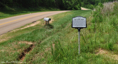
This historical marker provides details about a canoe fight on the Alabama River during the Creek War 1813-1814. The marker is located beside Madison …
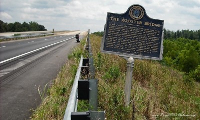
This historical marker is located near the west end of the new Rooster Bridge on U. S. Highway 80 that is across the Tombigbee River approximately 11 …

This is one of the oldest remaining covered bridges in Alabama. It was originally constructed across the Sucarnoochee River on the main state road lea …
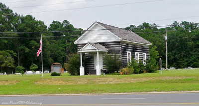
Andrews Chapel, also known as the McIntosh Log Church, is one of the few remaining log churches in Alabama. In 1860, John C. Rush and his wife donated …
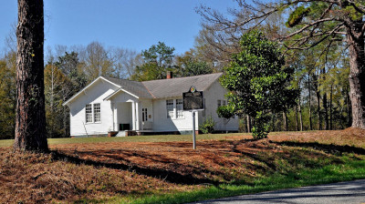
Located in front of this church is a historical marker. Following are the details provided on this marker: “This building was constructed c. 1849 as a …
Harper Lee, author of the Pulitzer Prize-winning novel, To Kill a Mockingbird, was born and raised in Monroeville, AL. The fictional town of Maycomb i …
This is just one of the many interesting things that you will find in the Old Cahawba Park that is located near Orrville, AL. Barker’s Slave Quarters …
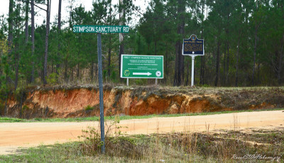
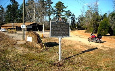
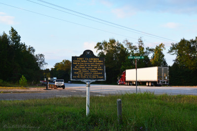
This marker is located in south Clarke County approximately 11 miles south of Jackson, AL on Co. Rd. 15 (Rockville Rd.) at the entrance to the Fred T. …
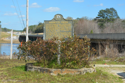
This historical marker provides details about how Bassetts Creek got its name. The marker is located beside US Hwy 43 approximately 1.5 miles north of …
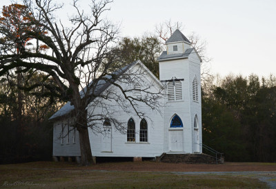
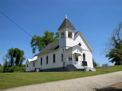
This church is located on Marengo CR 63 approximately 0.2 miles north of the junction of CR 63 & CR 38 and approximately 8 miles NE of Thomaston, …
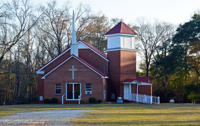
This church is located approximately 8 miles northeast of Thomaston, AL in the community of McKinley. It is on Marengo Co. Rd. 38 approximately 0.4 mi …
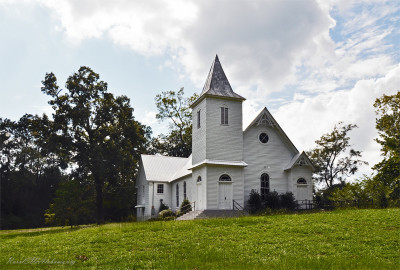
This church congregation was organized on October 21, 1900, with an enrollment of forty-eight members. The church was built on land donated by Mrs. Ju …
The Bored Well was started in 1854 and historians say an old blind mule pulled the auger around day after day until completion in 1857 of an artesian …
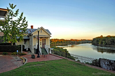
This small cottage is perched on a cliff overlooking the Alabama River just upriver from the historic Edmund Pettus Bridge in downtown Selma. Selma’s …
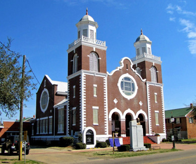
Brown Chapel AME Church, with its imposing twin towers and Romanesque Revival styling, was built in 1908 by black builder – of whom little is known – …
This historic church is located on the west side of Highway 43 in the community of Calvert at the intersection of Highway 43 and Fairford Road (GPS co …
This historical marker is located west of Thomasville on County Road 48 near the Bashi community (GPS coordinates N31.970778,W87.830889). It describe …
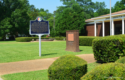
This historical marker is located beside Commerce Street in front of the James E. Arrington City Hall Complex near downtown Jackson (GPS coordinates 3 …
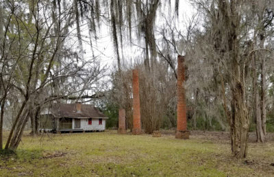
Situated near the Federal Road, this settlement began during the Mississippi Territory period with a ferry that transported settlers across the Alabam …
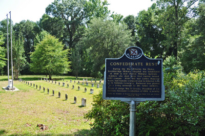
During the Civil War, Breckinridge Military Hospital was established at Howard College in Marion (now the campus of Marion Military Institute). Soldie …
Coretta Scott King (1927-2006) grew up on the farm of her parents, Obadiah “Obie” Scott and Bernice McMurray Scott, located north of Marion near the c …
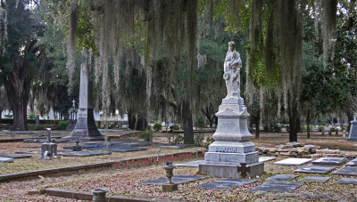
Cahawba, also spelled Cahaba, was Alabama’s first state capital (1820-1826). It became a ghost town shortly after the Civil War. Today, the old Cahawb …
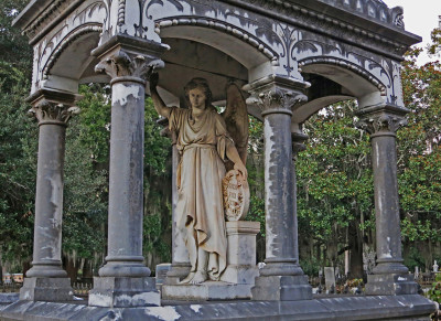
Provided are pictures of the memorial to Drury Fair Jones (1856-1878) that is located in the historic Old Live Oaks Cemetery at Selma. This beautiful …
Elodie Todd Dawson (1844-1881) was a staunch Confederate supporter and sister-in-law of Abraham Lincoln. Her husband, Col. N.H.R. Dawson (1829-1895), …
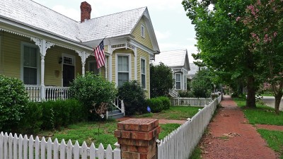
Once a gracious turn-of-the-century neighborhood, many of the homes here were close to condemnation when purchased by Circle “S” Industries, Inc. in 1 …
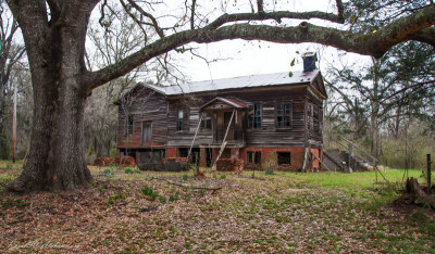
The Fambro-Arthur house gets its name from two of its owners. One was a judge, and the other was a former slave. Judge W. W. Fambro built this house i …
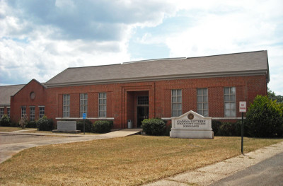
In 1891, nine agricultural schools, one in each congressional district, were authorized by the Alabama Legislature. One of the schools was located at …
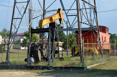
On January 2, 1944, the State of Alabama granted Hunt Oil Company a permit to drill the A. R. Jackson Well No. 1 at Gilbertown, AL. Hunt Oil Company …
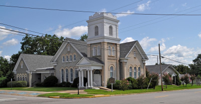
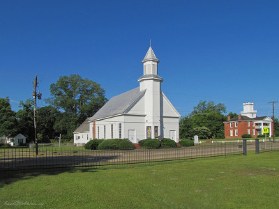
The First Presbyterian Church in Demopolis was organized by the Tuscaloosa Presbytery on November 1, 1839 with nine members. The congregation erected …
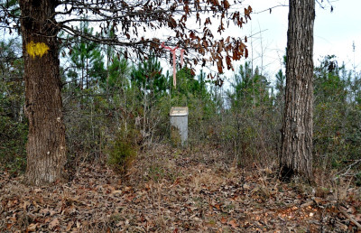
This historical marker identifies the former site of Fort Madison which was a stockade that was used during the Creek War 1813-1814. Fort Madison was …
This marker is located about 2 miles west of Perdue Hill in Monroe County on the south side of U.S. Highway 84 near the intersection of Lena Landegger …
In the fall of 1902, two men and three ladies filed a declaration to form the Fruitdale Union Chapel Association. Property for the church was purchas …
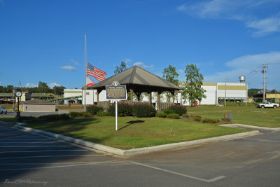
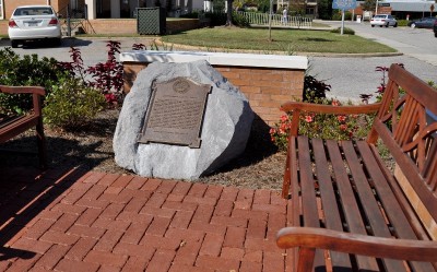
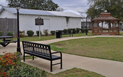
This historical marker is located on Main Street Circle in front of the gazebo that’s across the street from Fulton Town Hall (GPS coordinates 31.7887 …
Furman, AL is a small community located is eastern Wilcox County. On May 13, 1999, the “Furman Historic District” was placed on the National Register …
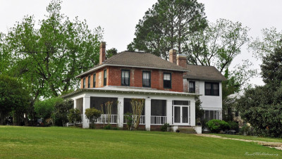
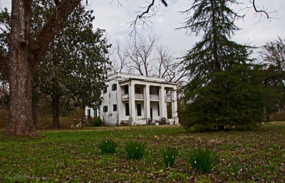
There may be no home in the Black Belt with more history attached to it than this one. It was built in 1828 – 1829 by John Gayle, a South Carolina nat …
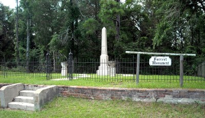
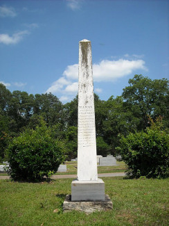
At the site of this monument, Gen. Nathan Bedford Forrest and his troops were paroled by Gen. Canby thus being the last troops east of the Mississippi …
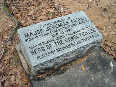
Jeremiah Austill is known as the Paul Revere of Clarke County. As a teenager, he volunteered to make a dangerous night ride to Mt. Vernon following th …
This historical marker is inside the Laurie Carleton Park that’s located at downtown Grove Hill in front of the Clarke County Courthouse (GPS coordina …
Around midnight on October 15, 1854, the four-story brick Howard College building (then located near the Siloam Baptist Church in Marion) caught fire. …