
This building was constructed in 1902 to house Andrew’s Hardware. It later became People’s Drug Store, a popular town meeting spot, until it closed in …
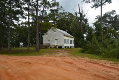
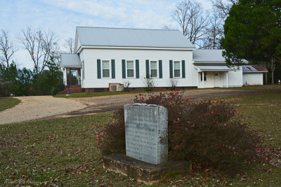
This church is located on a ridge in the hills of northeastern Clarke County. According to church records, the church congregation was organized in 18 …
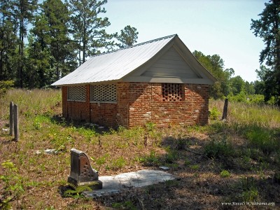
The Airmount Grave Shelter, also known as the Hope Family Grave Shelter, is a Greek Revival structure located in the Airmount Cemetery near Thomasvill …
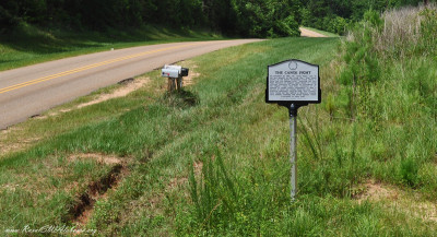
This historical marker is located beside Madison Road about three miles east of Gainestown in south Clarke County (GPS coordinates 31.445267, -87.6443 …
The Clarke County Historical Museum opened in 1986 as a project of the Clarke County Historical Society. It is located at downtown Grove Hill, AL in t …
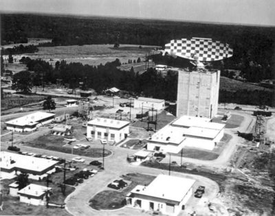
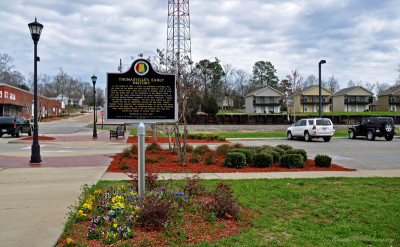
From 1958 to 1969, Thomasville was the location of an Air Force Radar Base which was home to the 698th Aircraft Control and Warning Radar Squadron. Th …

The old Blacksmith Shop, commonly referred to as the Red Shed, was built around 1895. Interestingly, it was built across the drainage ditch that runs …
This building was built around 1900 during the reconstruction of the downtown business district following a devastating fire in 1899. Bricked up arche …
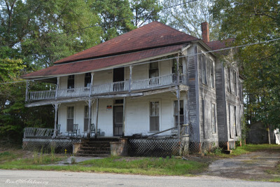
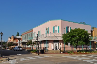
The Whatley Hotel is a two-story, wood frame, building with a steep hip roof and an attached, wraparound, two-tier gallery displaying Queen Anne desig …
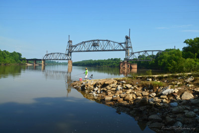
This is the second railroad bridge built across the Tombigbee River at Jackson. The first bridge was completed in 1888. In 1947, an order was received …
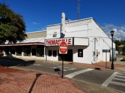
This historical marker is located on the south side of Wilson Street, between West Front Street and the railroad tracks, in downtown Thomasville (31.9 …
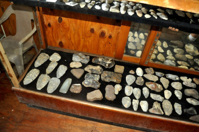
Tommy Hart lives in Carlton, AL which is located in the remote southern end of Clarke County near the forks of the Tombigbee and Alabama Rivers. He i …
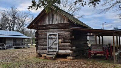
The Turner Corn Crib is believed to have been built with logs taken from the old Turner Fort which was a fortification used to protect settlers during …
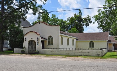
The Visitation Catholic Church is a Mission style building with stucco wall treatment. It was built around 1940. This church is a contributing propert …
The community of West Bend is located in west Clarke County approximately six miles northwest of Coffeeville. This historical marker is beside the Wes …
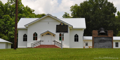
This historical marker is located on Main Street in front of the Horeb Baptist Church at Whatley (GPS coordinates 31.650388,-87.711215). Following is …
Williams’ Temple CME Church at Thomasville, AL (consolidated with Booker City to form Miles College)
In 1898, the Christian Methodist Episcopal Church, seeking to serve the educational needs of black students opened a school and church in Thomasville, …
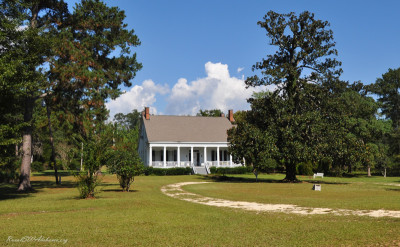
The Wilson-Finlay House is a historic plantation home located at Gainestown in southern Clarke County. This is one of only two Classical Revival style …
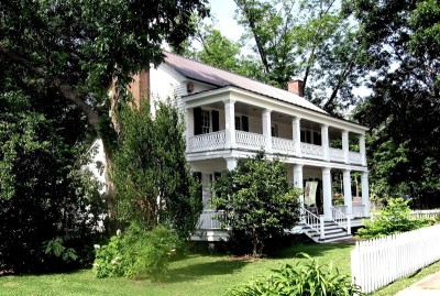
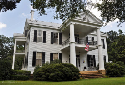
Constructed around 1840 as the seat of a 2,000 acre plantation, Woodlands is one of the finest of the few remaining antebellum homes in Clarke County. …
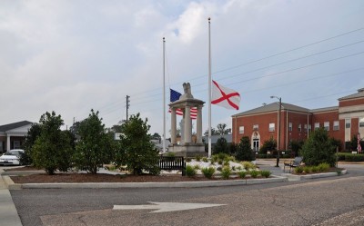
This monument was erected to honor the fallen military personnel of Clarke County who served in World War I. The stone monument sits atop an earthen m …
- 1
- 2